VeryGoodMaps
New York & Vicinity: Artistic Topographic Wall Map (36x24") – Detailed Map Print
New York & Vicinity: Artistic Topographic Wall Map (36x24") – Detailed Map Print
Couldn't load pickup availability
A stunning, wide-scale view of the Empire State and its neighbors.
Please note: map is not framed so you can pick the frames you like.
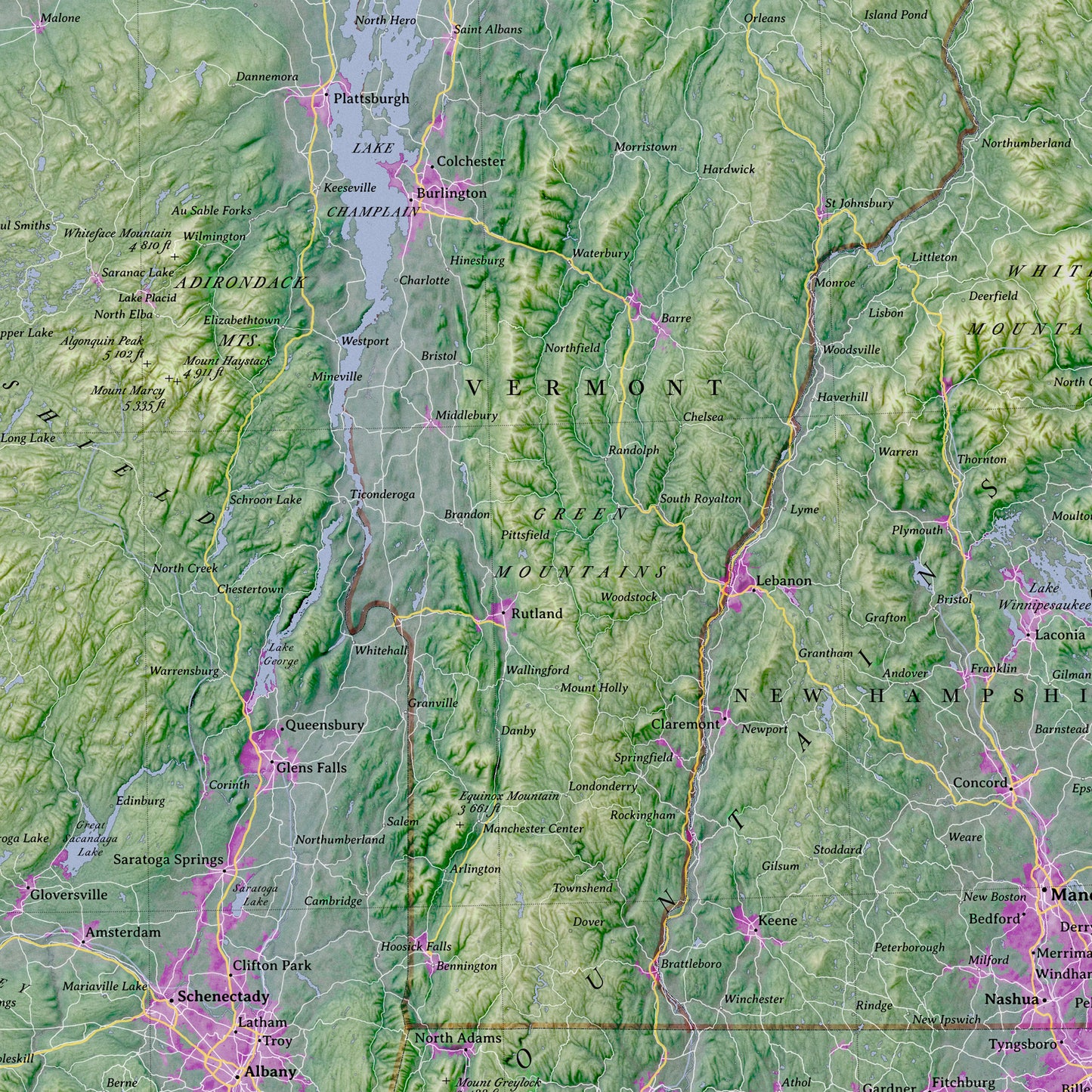
This large-format wall map of New York State and Vicinity blends modern geographical data with a classic, artistic aesthetic. Designed as a statement piece for your home or office, it moves beyond standard road maps to visualize the landscape itself.
The map features a rich, artistic elevation color scheme—distinguishing the high peaks of the Adirondacks and Catskills from the valleys of the Hudson and Mohawk—creating a vibrant picture of the Northeast's physical geography.
Map Features:
Expansive Coverage: Captures the complete state of New York along with key surrounding regions: New Jersey, Pennsylvania, Connecticut, Massachusetts, Vermont, and Southern Ontario.
Elegant Typography: Labeled with a sophisticated serif typeface for a timeless, readable look that fits both modern and traditional interiors. Note: some texts are small with dark background so they might be difficult to read.
Curated Detail: Features a carefully filtered road network that highlights major interstates and highways without clutter, alongside a tiered classification of cities and towns.
Specifications:
Scale: 1:930,000
Size: 36 x 24 inches
Projection: Transverse Mercator
Style: Physical/Political Hybrid with Artistic Topography
Perfect for anyone with a connection to New York, from the Great Lakes to the Atlantic Coast.
This product is made especially for you as soon as you place an order, which is why it takes us a bit longer to deliver it to you. Making products on demand instead of in bulk helps reduce overproduction, so thank you for making thoughtful purchasing decisions!
Share